Quick answer: Most Americans visiting Seoul should install Naver Map before the trip, keep KakaoMap or KakaoMetro as a backup, use Google Maps for saved places and general orientation, and carry a T-money card or compatible transit payment method for the subway gate. The best Korea subway apps setup is not one perfect app. It is one local route app, one backup app, working mobile data, airport-route awareness, and a small habit of checking the station name in English and Korean before you move.
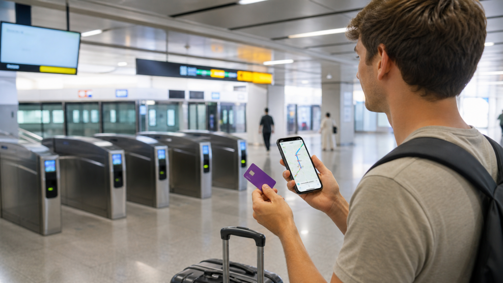
Seoul has one of the world’s most useful urban transit systems, but first-time visitors can still feel lost. The subway network is large, station names can repeat across transfers, exits matter, apps do not always behave the way Americans expect, and the trip from Incheon Airport into Seoul adds Airport Railroad choices before you even reach your hotel. A little setup turns the system from intimidating into one of the easiest ways to explore Korea.
This guide focuses on Korea subway apps for American visitors: Naver Map, KakaoMap, KakaoMetro, Google Maps, T-money, AREX airport routing, and the habits that keep a route plan sane. It is a practical travel-tech guide, not a generic list of app store links. You will learn which app to open first, which app to keep as a backup, when Google Maps is still useful, how to handle station exits, and what to check before airport days, late nights, rainy days, and luggage transfers.
The phone setup matters as much as the app. If your mobile data is unreliable, every route choice becomes harder. Read abcnote’s Korea eSIM or Pocket Wi-Fi guide before your trip so route search, live translation, hotel address lookup, and payment troubleshooting work the moment you land.
Korea subway apps in one minute
| Need | Best first choice | Backup or caution |
|---|---|---|
| Subway and walking route in Seoul | Naver Map | KakaoMap if the route looks odd or you want a second local opinion |
| Simple subway-only view | KakaoMetro or the subway layer inside a local map app | Check the final station direction before boarding |
| Saved tourist places | Google Maps lists can still help with planning | In Korea, local apps are usually stronger for detailed navigation |
| Airport to city route | AREX and airport public-transportation pages plus a local map app | Check express vs all-stop train timing and luggage effort |
| Gate payment | T-money or compatible transit payment setup | Keep cash/card backup for charging or buying a card |
| Language help | Translation app plus English station names | Do not translate while blocking a ticket gate |
Why Americans should not rely on only one map app
In many U.S. cities, a visitor can open Google Maps, tap transit, and trust the route. Korea is different enough that travelers should carry a local map habit. Naver Map and KakaoMap are built for Korean addresses, local search, subway transfers, bus stops, walking paths, and Korean place data. Google Maps remains useful for saved lists, broad orientation, reviews, and sharing places with friends, but it is not the only tool you want when you are choosing a subway exit in Seoul.
The difference shows up in small moments. A hotel may have a Korean place name that appears more clearly in a local app. A subway exit may matter because one exit puts you near an elevator and another puts you across a wide road. A transfer may look short on a map but feel long with luggage. A restaurant may be easier to find by Korean name than by an English romanization. Local apps reduce those frictions.
That does not mean Google Maps is useless. Use it for trip planning before departure, saved star lists, neighborhood orientation, and sharing pins with American travel companions. Then use a Korean app when the question is operational: which exit, which train direction, which transfer path, how long the walk is, and whether the place name matches the sign in front of you.
Best Korea subway apps setup for first-time visitors
Naver Map
Make this your primary app for Seoul routes, Korean place names, station exits, walking directions, and local search. Test it at home before your trip so the interface does not feel new at the airport.
KakaoMap
Keep this as a strong backup for local routing and place search. When one app’s walking path or transfer suggestion feels strange, checking the other app can prevent a frustrating detour.
KakaoMetro or subway view
A subway-focused app or subway map view helps you understand line colors, transfer stations, last train direction, and where a route changes lines.
Google Maps
Use saved lists, broad neighborhood planning, and familiar interface strengths, but do not make it your only live navigation tool in Korea.
T-money habit
A route app tells you where to go. A transit card gets you through the gate. Treat card setup and charging as part of app preparation.
AREX and airport pages
Airport days are special because luggage, timing, express trains, and terminal routes matter. Check official airport and Airport Railroad information before moving.
Before landing: install and test, do not improvise
Install your main apps before leaving the United States. Open each one, search for your hotel, search for Incheon Airport, search for Seoul Station, and try a sample route. This five-minute test matters because you will not want to create accounts, approve permissions, fight language settings, or learn a new interface while tired at the airport.
Save your hotel name in English and Korean if possible. Save the address as a screenshot. Save the nearest subway station and exit. If the hotel website lists airport transportation instructions, screenshot those too. Your phone should be useful even if a data plan fails for ten minutes.
For data, choose the simplest reliable setup for your travel style. A solo traveler with an unlocked modern phone may prefer an eSIM. A family that stays together may use pocket Wi-Fi. Travelers who split up need separate data plans or a clear backup. The Korea travel internet guide explains that decision in more depth.
At the airport: do this before your first subway ride
Airport arrivals are where app confusion often starts. You are tired, carrying bags, maybe looking for a restroom, and trying to decide between Airport Railroad, airport limousine bus, taxi, or hotel shuttle. The Seoul subway network is excellent, but the best route with luggage is not always the fastest route on a phone screen.
Check the official Incheon Airport public transportation page for airport-specific options, and check AREX for Airport Railroad information. Then compare your app route. The Airport Railroad Express train and all-stop train serve different needs, and your hotel location may make a bus or taxi more comfortable even if the subway looks cheaper.
| Airport situation | Good app habit | Practical note |
|---|---|---|
| First trip to central Seoul | Check AREX, airport page, and Naver Map | Compare express train, all-stop train, bus, and taxi with luggage in mind |
| Hotel near a subway station | Search hotel name and nearest station exit | The nearest exit may not have an elevator |
| Family with large bags | Prefer fewer transfers over theoretical speed | A transfer with stairs can erase the benefit of a faster route |
| Late-night arrival | Check last train and bus timing before leaving arrivals | Do not assume subway frequency is the same after midnight |
| Pocket Wi-Fi pickup | Finish pickup before relying on live routing | If the group needs one hotspot, nobody has navigation until it is working |
| eSIM activation | Activate and test before moving away from airport Wi-Fi | Fixing activation issues is easier near counters and stable Wi-Fi |
Station exits are the hidden skill
In Seoul, the station exit is often the difference between an easy walk and a confusing one. Large stations can have many exits. Some exits are across wide roads. Some are closer to elevators. Some are better for a market, palace, museum, hotel, or cafe street. Your app may suggest an exit, but you should still check the signs as you move.
When you search a destination, look for the exit number before you enter the station or while you still have space to stop. If you are meeting someone, share both the station name and exit number. If you are carrying luggage or traveling with children, look for elevator information and give yourself more transfer time.
Do not stand directly in front of gates, stairs, or escalators while deciding. Step to the side, check the app, then move. This one habit makes you calmer and keeps the flow polite.
How to read subway direction without panic
The main mistake is boarding based only on line color. A line color tells you which line you are on, not which direction the train is going. You need the destination direction, the next station, or the terminal station. Apps usually show the direction or final station. Platform signs usually show upcoming stations. Match the app to the sign before boarding.
Transfer stations can feel large because you may walk through long corridors between lines. If an app says a transfer takes several minutes, believe it. Seoul subway transfers are often clear, but they can be longer than expected with bags or tired legs. Build a few extra minutes into airport, show, restaurant, and tour reservations.
If you board the wrong direction, do not panic. Get off at the next stop, cross to the other side if the station layout allows it, and reroute. Keep your route app open, but also look at the station signs. The signs are often easier than trying to reinterpret a moving blue dot underground.
Naver Map vs KakaoMap vs Google Maps
| App | Best use | Limit |
|---|---|---|
| Naver Map | Primary live routing, station exits, local search, Korean place names, walking after subway | Interface may feel unfamiliar to Americans at first |
| KakaoMap | Backup routing, local place search, cross-checking walking paths and transit suggestions | Place data and interface habits may still require practice |
| KakaoMetro or subway app | Clear subway line view, transfers, line colors, station sequence, last-train awareness | Less complete for walking and destination discovery |
| Google Maps | Saved lists, familiar planning, broad geography, sharing places with travel companions | Not enough as the only live Korea transit tool for many visitors |
| Translation app | Reading signs, machine screens, alerts, and Korean place details | Camera translation can misread stylized text or crowded signage |
| Official transit pages | Airport, subway, and tourist transportation source checks | Not always the fastest way to make an on-the-ground route decision |
T-money and the gate: the app does not pay for you
Many visitors focus on route apps and forget the gate. Seoul subway travel usually depends on a transit card or compatible payment method. T-money’s official foreigner guide is a useful starting point. Depending on card type and current services, visitors may buy or charge transit cards in convenience stores, subway stations, or airport locations. Availability and rules can change, so verify during the trip.
Keep the payment habit simple. Tap in, tap out, keep the card in a consistent pocket, and do not bury it under your phone, passport, or room key. If a gate rejects the tap, step aside and solve it without blocking commuters. If the balance is low, recharge before entering a complex transfer day.
Privacy and account safety while navigating Seoul
Travel navigation uses sensitive data: hotel location, trip patterns, saved places, payment accounts, phone number, email, photos, and sometimes passport-related services. Do not install random transit apps from ads or social posts. Use official app stores, check the developer name, avoid unnecessary permissions, and keep your primary email and payment accounts protected.
If you use shared pocket Wi-Fi, hotel Wi-Fi, or public Wi-Fi, avoid sensitive account changes unless you trust the connection and understand the risk. For most visitors, the better plan is reliable mobile data plus strong account recovery. The passkeys or password managers guide is relevant because travel is exactly when a lost phone, weak password, or locked account becomes painful.
Also think about battery. A dead phone removes maps, translation, payment apps, hotel address, tickets, and communication. Carry a small power bank on long sightseeing days. Network reliability also matters; abcnote’s Wi-Fi 7 vs 6E guide is home-office focused, but the principle carries over: stable connectivity makes every digital workflow less stressful.
Route planning by traveler type
| Traveler type | Recommended setup | Why |
|---|---|---|
| Solo first-time visitor | Naver Map primary, KakaoMap backup, T-money card, eSIM | Fast, simple, independent movement across Seoul |
| Family with children | Naver Map, screenshots, fewer transfers, convenience-store breaks | Less walking and fewer rushed decisions matter more than shaving five minutes |
| Traveler with luggage | AREX/airport page plus local map, elevator-aware route | Station exits and transfer corridors matter more with bags |
| Food and culture explorer | Saved Google list plus local map routing by Korean place name | Saved ideas are useful, but local search helps at street level |
| Privacy-sensitive traveler | Official apps only, minimal permissions, strong account recovery | Navigation should not require risky app installs or weak account habits |
| Korean learner or expat | Local maps plus translation and Korean station-name practice | Reading station names improves confidence quickly |
Common subway app mistakes to avoid
Mistake 1: using Google Maps as the only live transit app
Google Maps is familiar, but Korea rewards local app habits. Keep it for planning and saved places, then use Naver Map or KakaoMap when you need exact local routing, station exits, and walking details.
Mistake 2: ignoring the exit number
The wrong exit can put you across a wide street, far from an elevator, or on the wrong side of a huge station. Always check the exit number before the final walking segment.
Mistake 3: choosing the fastest route with luggage
The fastest route on paper may have stairs, long transfers, crowds, or multiple line changes. With luggage, children, rain, or jet lag, choose the calmer route.
Mistake 4: learning the app underground
Underground navigation can be confusing because GPS may be weak. Learn the app above ground, save screenshots, and use signs inside the station.
Mistake 5: forgetting late-night timing
Subway frequency and last trains are not all-day assumptions. Check timing before late dinners, concerts, baseball games, flights, and night markets.
A simple Seoul subway workflow
Before leaving your hotel, search the destination in Naver Map. Confirm the station, line, transfer, and exit. Screenshot the route if the trip matters. Open KakaoMap if the route seems odd. Check whether walking time is realistic for your group. Confirm your T-money balance or payment method. Then move.
At the station, follow the line color and direction, but verify the next station or terminal direction before boarding. During transfers, follow signs first and your app second. Near arrival, check the exit number again. After leaving the gate, switch from subway thinking to walking thinking. That is where local maps often help most.
If you get lost, simplify. Find the station name, line number or color, and exit number. Step aside. Search the destination again. Ask station staff if needed. Seoul’s system is built for huge passenger flows, and many signs include English. Most mistakes are recoverable when you slow down for one minute.
Source notes and date checked
Sources were checked on July 22, 2026. Transit apps, card rules, airport routes, and official pages can change, so verify official information before travel and again before high-stakes airport transfers. This guide avoids claiming that one app or card setup works perfectly for every traveler; the durable recommendation is to pair a local map app with payment readiness, mobile data, airport-route checks, and station-exit habits.
- Visit Seoul official transportation guide
- Seoul Metropolitan Government English transportation information
- Seoul Metro official English site
- T-money official foreigner guide
- Airport Railroad AREX official site
- Incheon Airport public transportation guide
- Naver Map official service
- KakaoMap official service
- Google Maps Help: public transit directions
- Visit Korea official travel guide
Bottom line: use a local app, not app loyalty
The best Korea subway apps setup is practical, not ideological. Use Naver Map first for live Seoul navigation, keep KakaoMap or KakaoMetro as backup, keep Google Maps for saved places and familiar planning, and rely on official pages for airport and transit-card details. Add working data, a charged phone, a T-money habit, and exit-number discipline, and Seoul becomes much easier.
For American visitors, the winning move is to prepare before the first gate. Install the apps, test the hotel route, screenshot key addresses, understand the airport path, and carry a payment backup. Then the subway stops feeling like a language test and starts feeling like one of the best parts of traveling in Korea.
The exit number is a separate navigation decision
Imagine a correct subway route that brings you to the right station but the wrong side of a large road. The route's destination and the station exit need separate checks.
| Situation | Next check | Why it changes the decision |
|---|---|---|
| Before boarding | Confirm direction using the next station shown on the platform. | A matching line color does not confirm travel direction. |
| Before a transfer | Compare station signage with the app's interchange instructions. | Station layout is a separate practical problem. |
| Before leaving the station | Match the exit with the destination's Korean address or map pin. | The closest-looking exit can lead to a long detour. |
Use the live station signs and official notices when they conflict with a saved route. This example does not promise that a particular app supports every current route, translation, or payment feature.